


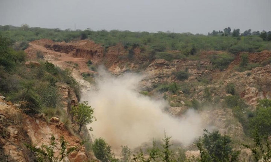
A standard, scientifically based definition of the Aravalli Hills and Ranges has been granted by India’s highest court, strengthening mining regulations in one of the nation’s most ecologically delicate regions. According to a government release, the Supreme Court of India adopted suggestions headed by the Ministry of Environment, Forest, and Climate Change to standardise the identification and protection of Aravalli landforms in decisions issued in November and December 2025.
According to the court, the historic hill system protects northern and western India from desertification, replenishes groundwater, and maintains biodiversity. The Aravalli Hills are defined by the court-backed framework as any landform that rises 100 metres or more above local relief, including any associated landforms and supporting slopes that are bounded by the lowest contour line.
Furthermore, an Aravalli Range will be formed by two or more of these hills that are 500 metres apart, giving intervening valleys, slopes, and hillocks legal protection. Therefore, even if individual portions of these mapped landforms are below the 100-metre height barrier, mining licences cannot be issued throughout them.
According to the official statement, this strategy eliminates the ambiguity that previously permitted states to interpret the law in different ways. Delhi, Haryana, Rajasthan, and Gujarat were consulted by a committee appointed by the Ministry of Environment, Forests, and Climate Change, which also examined current procedures. Since 2006, only Rajasthan has adhered to a formal definition, which was based on a state study from 2002 that used the Richard Murphy landform classification.
All of the states that took part in the discussions decided to adopt Rajasthan’s 100-metre criterion and make it stronger by adding ecological protections, transparency, and more precise mapping.
The committee identified core or inviolate areas where mining is still severely forbidden, established explicit protection for ranges, and mandated the marking of hills on Survey of India maps. The Supreme Court adopted the committee’s recommendations and temporarily prohibited new mining leases throughout the Aravallis in its final ruling on November 20, 2025.
Until a landscape-wide management plan for sustainable mining is created for the whole geological ridge extending from Gujarat to Delhi, the moratorium will be in place. The Indian Council of Forestry Research and Education will create the plan, which will be based on the Saranda forest model in Jharkhand.
Only active mines may continue to operate until then, and only under the committee’s tight guidelines for sustainable mining. A mining prohibition in core and inviolate zones, such as wetlands, protected areas, tiger reserves, eco-sensitive zones, and afforestation sites established with funding from the Compensatory Afforestation Fund Management and Planning Authority, was also approved by the court.
Only atomic, critical, and strategic minerals reported under the Mines and Minerals Development and Regulation Act are subject to limited exclusions; all other protections remain in place. Even in cases where declared eco-sensitive zones are smaller, the court ordered that no mining occur within one km of protected area limits.


Comments are closed